Coast Province
| Coast Province | |
|---|---|
| — Province — | |
 |
|
 |
|
| Coordinates: | |
| Country | |
| No. of districts: | 13 |
| Capital | Mombasa |
| Area | |
| - Total | 83,603 km2 (32,279.3 sq mi) |
| Population (1999) | |
| - Total | 2,487,264 |
| Time zone | EAT (UTC+3) |
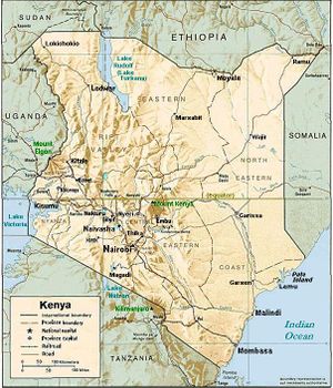
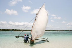
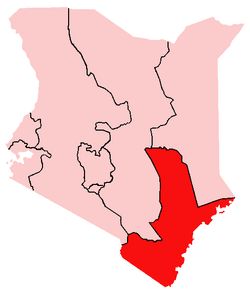
Coast Province of Kenya, along the Indian Ocean, is one of Kenya's seven administrative provinces outside Nairobi. It comprises the Indian Ocean coastal strip with the capital city at Mombasa and is inhabited by the Mijikenda and Swahili, among others. The province covers an area of 83,603 km² and has a population of 2,487,264 inhabitants (1999 census).
Other important towns on the coastal strip include Diani in the South, and Malindi, Watamu and Lamu in the North.
Diani Beach is now also a tourist center, with palm trees and the white sandy beaches like Mombasa.
Malindi is where Vasco da Gama picked up his pilot to navigate with the monsoon winds to India.
Watamu is a small fishing community and East Africa's first Marine National Park.
Contents |
Climate
The climate is tropical humid.
Districts
| District | Capital |
|---|---|
| Kilifi | Kilifi |
| Kwale | Kwale |
| Lamu | Lamu |
| Malindi | Malindi |
| Mombasa | Mombasa |
| Taita-Taveta | Wundanyi |
| Tana River | Hola |
Districts after 2007
Several new districts were created in 2007 in Kenya, including six in Coast Province [1]:
| District | Capital |
|---|---|
| Kaloleni | Kizurini |
| Kilifi | Kilifi |
| Kilindini | Dongo Kundu |
| Kinango | Kinango |
| Kwale | Kwale |
| Lamu | Lamu |
| Malindi | Malindi |
| Mombasa | Mombasa |
| Msambweni | Msambweni |
| Taita | Wundanyi |
| Tana Delta | |
| Tana River | Hola |
| Taveta | Taveta |
References
|
|||||||||||